Uwharrie National Forest: Hiking, Camping and the Piedmont Hills of North Carolina
The Uwharrie is the inland half of what this guide covers — roughly 50,000 acres of the North Carolina Piedmont, a long way from the coast and a completely different kind of walking. Map sheets and route detail sit on the Uwharrie maps page.
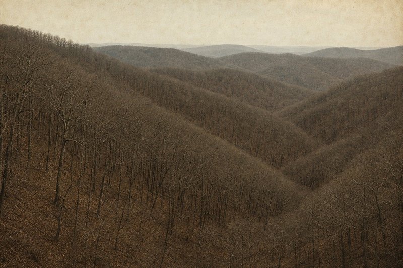
01 — The forestAn old range worn down to hills
The Uwharrie Mountains are among the oldest in North America, and it shows in the shape of them: no peaks, no exposed summits, just a dense succession of steep wooded rises separated by creeks. The elevation figures are unimpressive and the walking is not — a day here involves considerably more ascent than a day on the Neusiok, distributed in short sharp doses.
The forest sits across Montgomery, Randolph and Davidson counties in the Piedmont, close enough to the Charlotte and Triad populations to be genuinely busy at weekends. That proximity is the main practical difference from the coastal forest: solitude takes more effort to find here. The Forest Service's Uwharrie National Forest pages carry the current recreation and access detail.
02 — WalkingThe recreation trail and the loop
The Uwharrie National Recreation Trail runs roughly 20 miles broadly north to south and is the forest's main walking route. Dutchman's Creek Trail leaves and rejoins it to form a longer connected circuit, which is why most trip reports here describe a loop rather than an end-to-end.
Two or three days covers the combined route comfortably. Road crossings allow shorter sections, and the primitive campgrounds serve as staging points — detail on the Uwharrie camping page.
Field noteWater is more reliable here than in the Croatan but the creeks still drop in late summer. Check current conditions rather than assuming a flowing crossing.
03 — WildernessThe Birkhead Mountains Wilderness
The northern block is designated wilderness: no vehicles, no bicycles, minimal signage and a trail network that carries a fraction of the main corridor's traffic. It is the closest thing the Piedmont offers to genuinely quiet walking.
It is also where navigation matters most. Junctions are faint, the woodland is uniform, and there is little to fix a position against — which is why the map sheets are worth carrying here even by people who would not bother elsewhere in the forest.
04 — Other usesVehicles, hunting and sharing the forest
The Uwharrie is a working multi-use forest and busier than the Croatan in almost every respect. A substantial off-highway-vehicle network operates on the western side near Badin Lake, and it is audible from some of the walking nearby — worth knowing before choosing a first visit there rather than in the Birkheads.
Hunting is significant from autumn into early winter, as it is across the state's public land. Blaze orange is sensible in those months and season dates are published annually by the NC Wildlife Resources Commission; the forest service page covers the related permit questions, and other routes across the Carolinas are collected on the trails index.
05 — QuestionsCommon questions about the Uwharrie
Where is Uwharrie National Forest?
In the North Carolina Piedmont, across Montgomery, Randolph and Davidson counties — roughly 50,000 acres of wooded hills well inland from the coast.
Is primitive camping allowed in the Uwharrie?
Yes. Dispersed backcountry camping is permitted without a permit, alongside developed campgrounds at Badin Lake and primitive sites including West Morris Mountain and the Uwharrie Hunt Camp.
How high are the Uwharrie mountains?
Low — these are the eroded remnants of a very old range, so the walking is a succession of steep-sided hills rather than anything alpine. The gradient is real without the altitude.
Is the forest noisy with off-road vehicles?
In parts. There is a substantial OHV network on the western side near Badin Lake, and it is audible from some of the nearby walking. The Birkhead block at the northern end is the quiet alternative.
How does it compare with the Croatan?
Almost completely different. The Croatan is flat coastal pocosin and pine at sea level; the Uwharrie is dry wooded hills with real ascent and descent. The Uwharrie is also the more heavily used of the two.
When is the best time to visit?
Autumn and spring. Summer is hot and humid though less insect-plagued than the coast, and the leafless months open up views the canopy hides for the rest of the year.