The Neusiok Trail Section by Section: Blazes, Boardwalks and Upkeep
The practical detail of the route itself — how the three sections divide, how the marking system works, and why a few hundred yards of raised timber matter more than anything else on this trail. The route overview and planning notes are on the main trail page.
01 — SequenceThe three sections in order
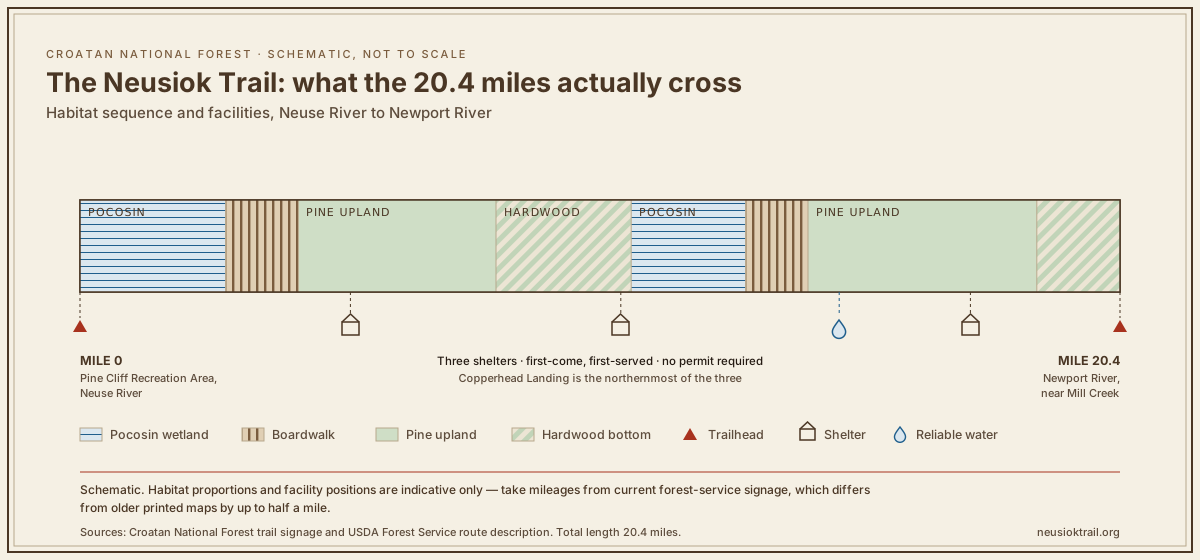
The trail divides at the road crossings into three walks of roughly similar length. The sequence of habitat is what distinguishes them, and it is abrupt rather than gradual.
Northern section
Pocosin from close to the river, with the heaviest boardwalk provision on the trail, closing at Copperhead Landing. The wettest walking and the section most affected by recent rain — the Pine Cliff trailhead page covers the approach and the first miles.
Middle section
Pine upland, firm tread, the fastest miles. What passes for elevation on this trail is here.
Southern section
Back into pocosin and hardwood bottom before the Newport River. Flat, and slow when wet.
02 — MarkingsBlazes and trail markings
Painted blazes on trees carry the route. In the pine upland they are frequent and the trail is obvious without them; in the pocosin they become the only reliable indication of where the path is, because the tread itself splits and rejoins around standing water.
The practical rule is the standard one: if you have not seen a blaze in a while, stop and go back to the last one rather than continuing on what looks like a path. In this forest what looks like a path is frequently a drainage line.
Field noteBlaze paint fades faster in this humidity than in drier climates. Re-blazing is one of the recurring jobs on volunteer work days.
03 — StructuresThe boardwalk system
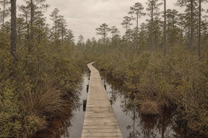
The boardwalks are the trail's defining piece of infrastructure. They cross the sections of pocosin where the ground simply does not drain, and their existence is the reason the northern miles are walkable at all outside a dry spell.
They also fail. Timber in a saturated environment has a limited life, storms damage the structures, and repair requires carrying materials into ground that is difficult to reach. A closed or damaged boardwalk section is among the more common reasons for a trail closure notice — the trailhead kiosk boards are the fastest place to learn about one.
04 — UpkeepWho keeps the trail open
The Forest Service is responsible for the trail, but a great deal of the actual work has come from volunteers — organised work days clearing fallen timber, repairing boardwalk, cutting back growth and re-blazing. In a forest where a single storm can drop hundreds of trees across the corridor, that labour is the difference between a maintained trail and a notional one.
The local wildlife club has long been associated with that effort, and much of the trail's continuity is owed to it. Anyone walking the route in good condition after a hard winter is benefiting from work done by people with chainsaws in February. Related detail sits on the Croatan forest page and the shelters page.
05 — QuestionsCommon questions about the trail itself
How is the Neusiok Trail blazed?
With painted blazes on trees along the route. The upland sections are consistently marked; the pocosin stretches are where blazes sit further apart and the tread braids, so attention matters more.
How many boardwalk sections are there?
Several, concentrated in the wettest pocosin. They exist because without them the tread stays ankle-deep for weeks after heavy rain, so their condition is the single biggest factor in how the northern miles walk.
Who maintains the trail?
The Forest Service with substantial volunteer input. Organised work days have historically cleared timber, repaired boardwalk and re-blazed sections — labour-intensive work in this terrain.
What happens to the trail after a hurricane?
Fallen timber closes sections, sometimes for months. Clearing across pocosin is slow and access for equipment is poor, so a storm in September can affect the autumn walking season.
Can I walk just one section?
Yes, and most people do. The mid-trail road crossings divide the route into three practical day-walks, each with parking and usually a kiosk board.
Are bicycles or horses allowed?
The Neusiok is a foot trail. The boardwalk structures in particular are built for walkers, and neither bikes nor horses belong on them.