Neusiok Trail Map, Croatan Forest Sheets and Uwharrie GPX Files
Map sheets and navigation notes for the trails covered here, kept at their original addresses so older links and printed references still resolve.
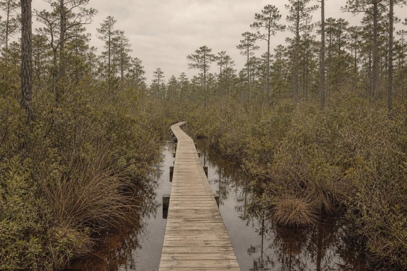
01 — Neusiok TrailNeusiok Trail map and section tracks
The Neusiok Trail runs 20.4 miles from Pine Cliff Recreation Area on the Neuse River to the Newport River near Mill Creek. Section boundaries fall naturally at the road crossings, which is how most walkers break the route into day-hikes rather than a single push.
The pocosin stretches are the ones worth carrying a map for. There, the tread braids around standing water and the blazes sit further apart than in the uplands, so a wrong turn is easier to make and slower to notice. In the pine upland the blazing is good enough that a map is close to a formality.
A full breakdown of the terrain sequence, the shelters and the reliable water sits on the trail overview, and the trailhead boards are covered on the kiosk page.
Field noteMileages on the kiosk boards and on older printed maps disagree by up to half a mile. Current forest-service signage is the figure used throughout this guide.
02 — Weetock TrailThe Weetock Trail on the White Oak side
The Weetock Trail covers the western reach of Croatan National Forest along the White Oak River, and it sees a fraction of the Neusiok's traffic. Documentation is correspondingly thinner: it appears on the forest-wide sheets rather than on a dedicated map of its own.
That makes it the route where navigation attention pays off most. Detail on the trail itself is on the Weetock Trail page.
03 — CroatanCroatan National Forest sheets
Forest-wide sheets cover the Neusiok and Weetock trails, the campgrounds, the wilderness areas south of the Neuse, and the forest-road network — which in the Croatan is dense enough to matter for access. They are more useful for planning a road approach than for close navigation on foot.
The Forest Service publishes both a visitor map and guide index for the North Carolina forests and a dedicated Neusiok Trail guide (PDF). Those are the authoritative sheets; everything on this page is secondary to them.
Camping, campground and access detail for the forest sits on the Croatan page.
04 — UwharrieThe Uwharrie National Forest map set
Three large-format Uwharrie sheets were kept on the original site and are preserved here at their original addresses. They are scans of roughly 16 by 24 inches, sized for printing rather than for reading on a phone, and they cover the inland forest — the National Recreation Trail, Dutchman's Creek, Badin Lake and the Birkhead Mountains.
- Uwharrie sheet A1 — 5.1 MB PDF — north: the Birkhead Mountains Wilderness and its trail network
- Uwharrie sheet A2 — 5.3 MB PDF — middle: the central recreation-trail corridor around Ophir
- Uwharrie sheet A3 — 4.7 MB PDF — south: the NC 24/27 trailhead, Dutchman's Creek and Badin Lake
Per-trail notes and the wider context are on the Uwharrie maps page.
05 — DigitalGPX files, apps and offline coverage
None of the sheets here are digital tracks, so a GPX file has to be built elsewhere — CalTopo and Gaia GPS are the usual choices, working from the published route. Whichever app you use, download the surrounding area for offline use before leaving the trailhead: coverage across both forests is patchy, and on the Uwharrie ridges it is worse than patchy.
Paper and phone answer different questions. The phone tells you where you are, which is the hard part in continuous woodland or featureless pocosin. The paper sheet shows what is around you, and it keeps working on the third afternoon.
06 — QuestionsCommon questions about the trail maps
Is there a single Neusiok Trail map that covers the whole route?
The Forest Service sheet for Croatan National Forest covers the full corridor, though at a scale better suited to orientation than to close navigation. Most walkers carry that plus the section detail from the trailhead kiosk boards.
Where does the Weetock Trail map come from?
The Weetock route sits on the White Oak River side of the forest and appears on the same forest-wide Croatan sheets. It is less well documented than the Neusiok, and correspondingly less travelled.
Are the Uwharrie map sheets on this site current?
No — they are scans kept from the original guide, so they will not reflect any reroute made since they were drawn. They are preserved as a historical reference; check the current Forest Service sheet before committing to a route.
Can I get GPX tracks for these trails?
Not from this page — the sheets here are paper scans, not digital tracks. Most people build a GPX file in CalTopo or Gaia GPS from the published route and carry the printed sheet alongside it.
Do I need a map at all on the Neusiok Trail?
In the upland sections, not really — the blazing is good. In the pocosin it is a different matter: the tread braids around standing water and the blazes can sit further apart than is comfortable.
Why do the mileages on different maps disagree?
Older printed maps and the kiosk boards differ by up to half a mile in places, mostly the legacy of reroutes around wet ground. Current forest-service signage is the figure used across this guide.