Driving to the Neusiok Trail: the Trailheads, Crossings and Forest Roads
Croatan National Forest sits on the coast between the Neuse and White Oak rivers, and the approach is straightforward — the complications, such as they are, come from the forest-road network rather than from the highways.
01 — The approachGetting to the forest
The forest lies south and east of New Bern, wrapped around Havelock and reaching down toward Newport and the coast. Most people arrive from the New Bern side or up from Morehead City, and either way the last part of the journey leaves paved highway for graded forest road.
Havelock and Newport are the two towns that matter for provisioning. Inside the forest there is nothing — no shop, no fuel, no reliable water — so whatever you need should be in the car before you turn off the highway. That includes drinking water, which is worth saying plainly because the forest is full of water and almost none of it is something you want to drink untreated.
02 — North endThe northern trailhead at Pine Cliff
The northern terminus sits at Pine Cliff Recreation Area on the Neuse River, which doubles as a day-use area — so the parking is more established here than at most access points, and there is usually somebody about. It is the conventional place to start a southbound walk.
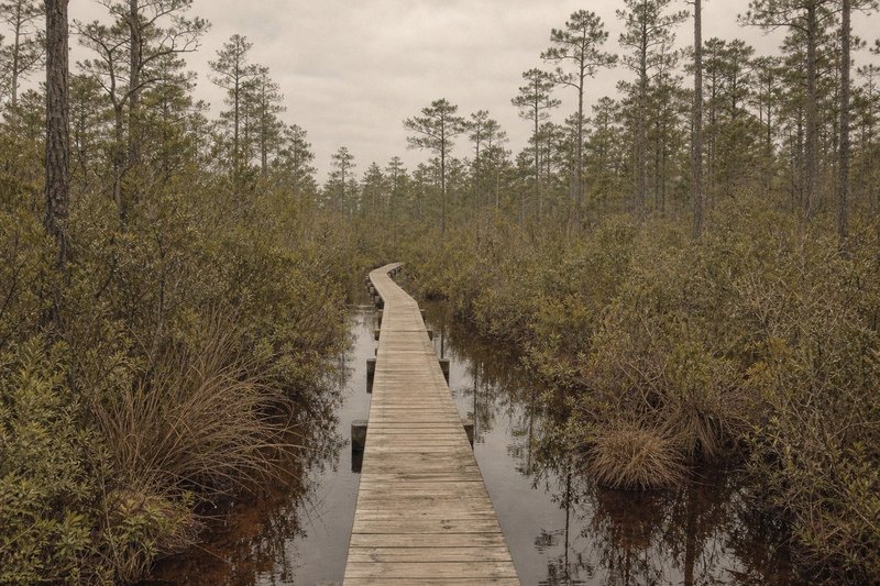
The trail drops into pocosin almost immediately from this end, which surprises people who have parked beside a wide river expecting easy walking. The first miles are the wettest on the route.
Field noteRecreation-area gates can close outside day-use hours. If you are leaving a car overnight, check the posted times on the board before you walk away from it.
03 — South endThe southern trailhead near the Newport River
The southern end reaches the Newport River near Mill Creek. Access is off the forest-road network on the Newport side, and the parking is plainer than at Pine Cliff — a lot rather than a facility.
This end suits anyone basing themselves at Oyster Point Campground, which sits nearby on the water, or walking north into the hardwood bottom and pocosin of the final miles.
04 — Road crossingsThe mid-trail crossings and section walks
Several roads cross the trail between the termini, and they are the reason the Neusiok works well as a set of day walks rather than only as a thru-hike. Each crossing is a viable start or finish, most have space to leave a car, and most carry a kiosk board with a section map.
Two cars and a crossing removes the shuttle problem entirely: leave one at each end of the section you want, walk it one way, drive back. It is the arrangement most regulars settle into.
05 — Forest roadsRoad conditions inside the forest
The forest roads are graded sand and clay, and they behave accordingly. Dry, they are fine for any car. Wet, they rut and hold water in the low sections, and the low sections are numerous — this is flat coastal ground where drainage is the exception rather than the rule.
Conditions change faster than any web page can track, so treat the trailhead boards and the Forest Service as the authority. After a named storm, assume roads and trail sections are closed until something tells you otherwise; clearing fallen timber across pocosin takes weeks, sometimes longer. The Croatan overview covers the wider forest, and the seasonal page covers when any of this is comfortable.
06 — QuestionsCommon questions about driving and access
Where is the nearest town to the Neusiok Trail?
Havelock sits closest to the northern end, and Newport to the southern. Both put you within a short drive of a trailhead, and both carry the practical things — fuel, food, a hardware store — that are absent inside the forest.
Can I leave a car at the trailhead overnight?
Overnight parking at the trailheads is the normal arrangement for anyone walking the trail in sections or end to end. Leave nothing visible in the car; these are quiet lots in a large forest.
Do I need a high-clearance vehicle for the forest roads?
Not usually. The main forest roads are graded and passable in an ordinary car, but they deteriorate after heavy rain and this coast gets a lot of it. If the surface looks freshly rutted, believe it.
Is a shuttle needed to walk the whole trail?
For a true end-to-end walk, yes — the termini are 20.4 miles apart with no loop. The mid-trail road crossings are what make section walks practical without one.
How do I reach Oyster Point Campground?
It sits on the water in the southern part of the forest, reached from the Havelock and Newport side via the forest-road network. Detail is on the Oyster Point Campground page.
Is there mobile coverage at the trailheads?
Patchy and not to be relied on. Download maps for offline use before you leave the tarmac rather than after.